

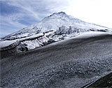
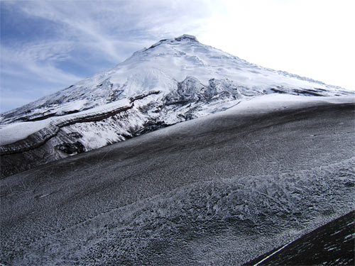
Cotopaxi volcano (Ecuador) is one of the highest volcanoes (5,897 m) on earth. Its composite cone is located 50 km south of the capital Quito within the Interandean Depression, a graben-like structure that separates the western and eastern Cordilleras. Cotopaxi exhibits a complex intercalation of basic to intermediate lavas, pyroclastic deposits and silica-rich domes. The crater has a diameter of 800 m and is about 300 m depth. The glacier-covered flanks extend from the crater rim downward to an altitude of 4,800 m.
Since the first reported eruption in 1534 Cotopaxi has erupted at least 35 times. In the years 1534, 1742-1744, 1766, 1768 and 1877 very explosive events with pyroclastic flows, ash fallouts and lahars occurred. The last major eruption took place in 1877. Devastated buildings in the city of Latacunga, which lies 30 km southeast of Cotopaxi, show how vulnerable communities in the surrounding valleys are.
The average recurrence of such hazardous events is 117 years (Barberi et al. 1995) and is already reached at this stage. Since December 2001 increased seismic and fumarolic activity as well as minor phreatic eruptions, show an increasing activity of Cotopaxi. Therefore, it has to be assumed that a greater eruption will occur in the near future.
Especially plinian eruptions are known to be very hazardous at Cotopaxi. These eruptions, that can evoke eruption columns with heights exceeding 30 km, are related to differentiated and therefore volatile-rich magmas which are typical for active continental margins.
As a result of these plinian eruptions pyroclastic flows are able to extensively melt snow and ice and to produce large lahars that are considered to be the most destructive phenomena at Cotopaxi.
This project is part of an international collaboration with teams from Ecuador, Mexico and Italy, which focuses on the characterization of the eruptive behavior of Cotopaxi and consequently wants to specify the volcanic risk.
The aim of this investigation is to decipher the eruptive behavior of Cotopaxi under geochemical aspects with special emphasis on the lava flows and domes. Element and isotope geochemistry as well as petrology should give insight into the magmatic evolution and the different stages of volcanic activity. Moreover, it should be shown how the regional structural setting has influenced the emplacement of silica-rich domes at the flanks of Cotopaxi.
Barberi, F., Coltelli, M., Frullani, A., Rosi, M., and Almeida, E., 1995. Chronology and dispersal characteristics of recently (last 5000 years) erupted tephra of Cotopaxi (Ecuador); implications for long-term eruptive forecasting. J. Volc. Geotherm. Res. , 69: 217-239
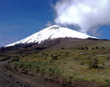
Cotopaxi (5,897 m, Ecuador), an active volcano of the subductio-related volcanism of the Andes.
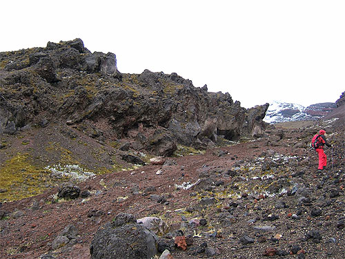
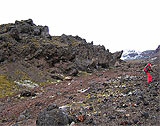
Andesitic lava flow on the SW flank of the Cotopaxi.

View to the north side of the Cotopaxi.